
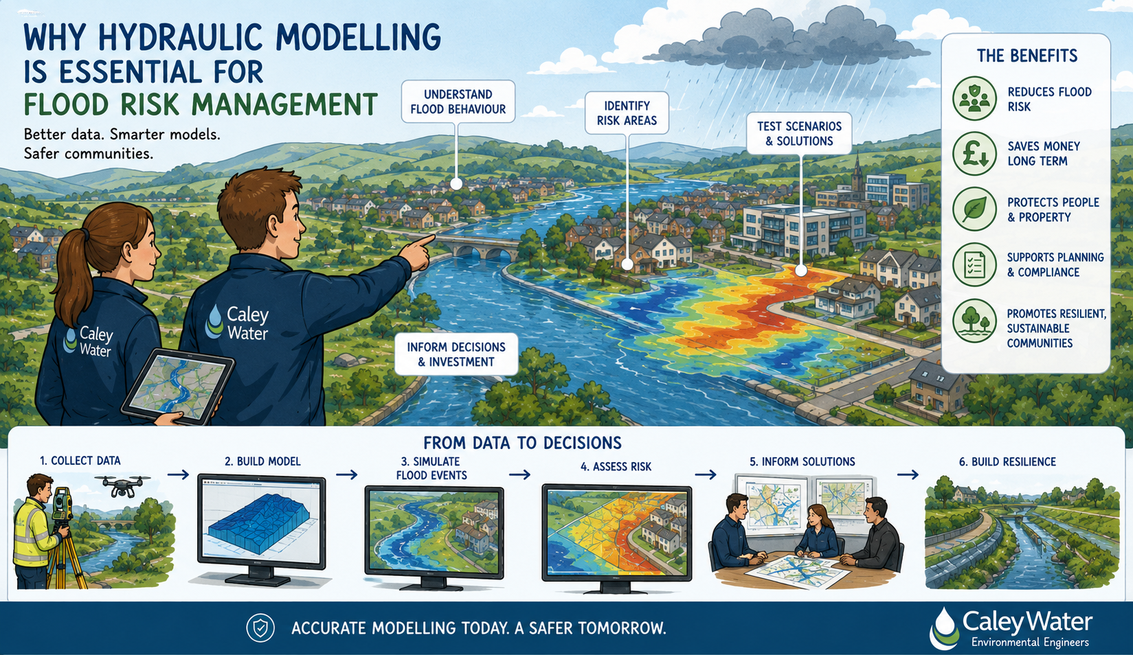
Flood risk is an important consideration for developers, local authorities, infrastructure providers and landowners across Scotland. With changing rainfall patterns, growing pressure on drainage networks and increasing development in sensitive locations, understanding how water behaves is more important than ever.
Hydraulic modelling provides a detailed way to assess, predict and manage flood risk. Rather than relying on assumptions, a hydraulic model uses data to simulate how water moves through rivers, drainage systems, culverts, sewer networks and overland flow paths. This helps project teams make informed decisions at an early stage and avoid costly problems later in the development process.
What Is Hydraulic Modelling?
Hydraulic modelling is the process of creating a digital representation of a water system. This may include rivers, watercourses, drainage networks, surface water routes, culverts, storage areas and surrounding land levels.
The model can then be used to test different rainfall events, flow conditions or development scenarios. This allows consultants and engineers to understand where flooding may occur, how deep it may be, how quickly water may move, and what impact a proposed development or infrastructure change could have.
For planning applications, flood studies and drainage strategies, this level of evidence can be invaluable.
Supporting Better Planning Decisions
A well-prepared hydraulic model can support flood risk assessments, drainage assessments and wider environmental studies. It gives planning authorities, developers and design teams a clearer understanding of potential flood mechanisms and any mitigation that may be required.
This is particularly important where a site is close to a watercourse, located in a low-lying area, affected by surface water flow paths, or connected to existing drainage infrastructure.
By identifying flood risk early, project teams can design around constraints rather than reacting to them later. This may include adjusting site levels, incorporating storage, improving conveyance, protecting key access routes or designing sustainable drainage measures.
Reducing Uncertainty
Flood risk is complex. Water does not always follow obvious routes, and small changes in ground levels, culvert capacity or drainage layout can have a significant impact.
Hydraulic modelling helps reduce uncertainty by showing how water is likely to behave under different conditions. It can also help compare options, test mitigation measures and demonstrate whether a proposed solution is effective.
For example, a model may be used to assess whether a culvert is restricting flow, whether a development could increase flood risk elsewhere, or whether a proposed drainage strategy provides sufficient capacity during extreme rainfall.
Helping Projects Move Forward
High-quality modelling can help avoid delays by providing clear technical evidence. When flood risk and drainage matters are not properly addressed, projects can face objections, redesigns or additional information requests.
By investing in hydraulic modelling at the right stage, clients can support smoother planning, better design and stronger long-term resilience.
Caley Water’s Role
Caley Water provides specialist hydraulic modelling and environmental consultancy services for a range of projects. By combining technical modelling expertise with practical engineering understanding, Caley Water helps clients assess flood risk, investigate drainage issues and develop robust water management solutions.
Whether the project involves a development site, sewer network, river system or drainage study, hydraulic modelling can provide the evidence needed to make confident decisions.
Conclusion
Flood risk management is not simply about responding to problems after they occur. It is about understanding risk, planning carefully and designing solutions that work.
Hydraulic modelling plays a key role in that process. It gives project teams the technical insight needed to manage water effectively, support planning requirements and protect people, property and infrastructure from future flood risk.